
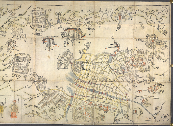
Nagasaki Harbour; Nagasaki Ezu. Map of Nagasaki (right hand side; cropped). Woodcut; band coloured. Decorated with ships and figures of foreigners. There is a table of distances between Japan and various foreign countries.Originally published / produced in 1680.1680.Or. 75. g. 25; RHSLondon; British Library.
| px | px | dpi | = | cm | x | cm | = | MB |
Details
Creative#:
TOP20495166
Source:
達志影像
Authorization Type:
RM
Release Information:
須由TPG 完整授權
Model Release:
No
Property Release:
No
Right to Privacy:
No
Same folder images:
Restriction:
Additional permissions needed for non-editorial use.
 Loading