
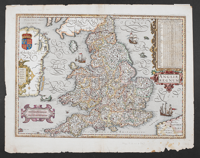
Christopher Saxton.A map of England.c. 1600?.From: Christopher Saxton; Angliae Regnum. Christophorus Saxton describebat 1579. Petrus Kaerius caelavit.Maps C. 2. cc. 2. (17.) London; British Library.
| px | px | dpi | = | cm | x | cm | = | MB |
Details
Creative#:
TOP20494699
Source:
達志影像
Authorization Type:
RM
Release Information:
須由TPG 完整授權
Model Release:
No
Property Release:
No
Right to Privacy:
No
Same folder images:
Restriction:
Additional permissions needed for non-editorial use.
 Loading