
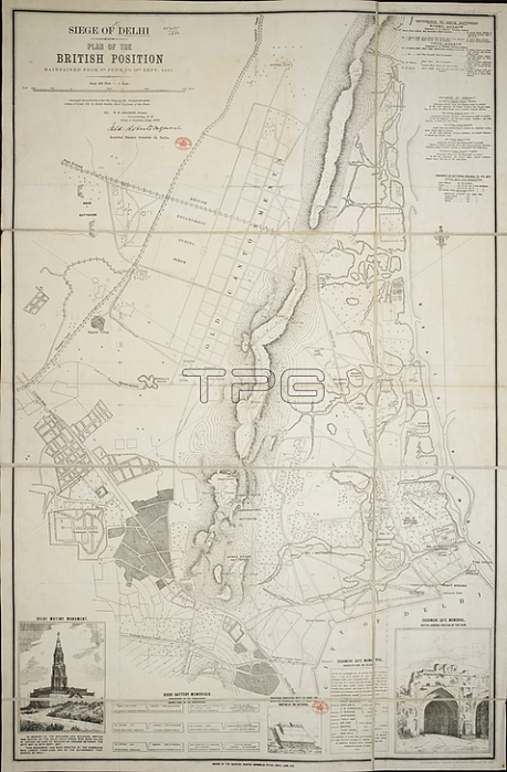
A 19th century plan of Delhi relating to the siege in 1857.From: Siege of Delhi. Plan of the British Position maintained from 8th June to 14th Sept. 1857. Surveyed. by Mr. Dodsworth under orders of Lieut. Col. R. BairdSmith; Chief Engineer of the Force. Scale; 500 feet = 1 inch.Maps. 55455. (10)London; British Library.
| px | px | dpi | = | cm | x | cm | = | MB |
Details
Creative#:
TOP20493244
Source:
達志影像
Authorization Type:
RM
Release Information:
須由TPG 完整授權
Model Release:
No
Property Release:
No
Right to Privacy:
No
Same folder images:
Restriction:
Additional permissions needed for non-editorial use.
 Loading