
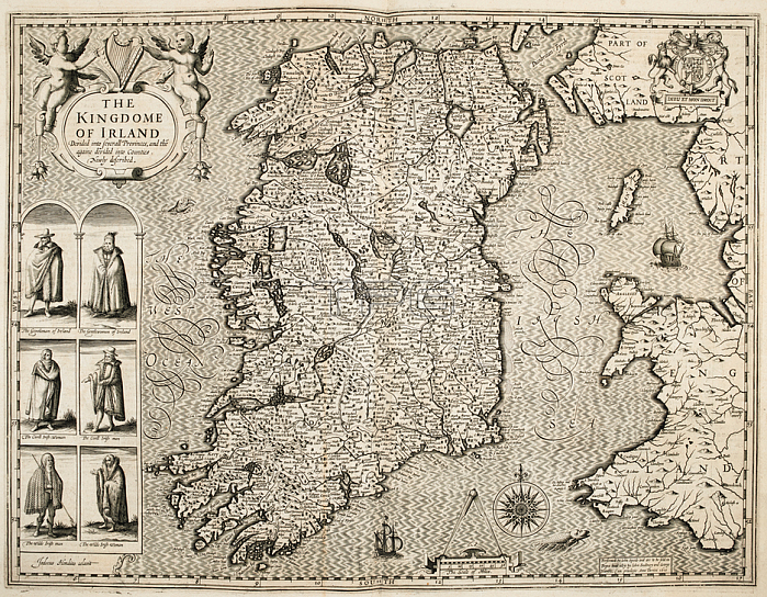
John Speed.A 17th century map of Ireland; with figures representing types of Irish people.London: J. Sudbury & G. Humble; 1611-1612.From: John Speed; The Kingdome of Irland divided into severall Provinces; and the~ againe devided into Counties. Performed by J. Speede. 1610. The scale of miles; 30[ = 45 mm.] J. Hondius coelavit.G. 7884London; British Library.
| px | px | dpi | = | cm | x | cm | = | MB |
Details
Creative#:
TOP20493238
Source:
達志影像
Authorization Type:
RM
Release Information:
須由TPG 完整授權
Model Release:
No
Property Release:
No
Right to Privacy:
No
Same folder images:
Restriction:
Additional permissions needed for non-editorial use.
 Loading