
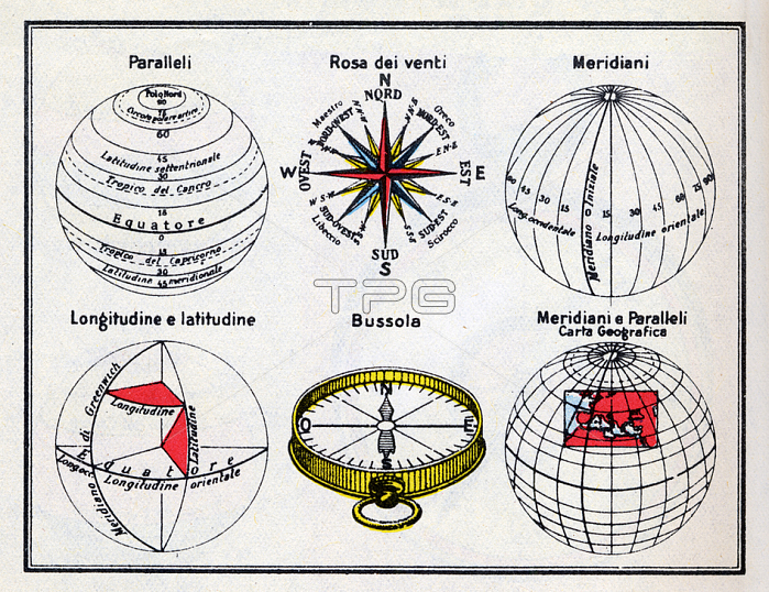
GEOGRAPHY diagram illustrating the measurement system of the globe through the coordinates of longitude and latitude measured on Meridians and Parallels. The indication of the Greenwich meridian as the longitude 0 suggests that the scheme has been implemented after the Washington Conference of 1884 for the Convention on Universal Time. Italy; sd
| px | px | dpi | = | cm | x | cm | = | MB |
Details
Creative#:
TOP20236461
Source:
達志影像
Authorization Type:
RM
Release Information:
須由TPG 完整授權
Model Release:
No
Property Release:
No
Right to Privacy:
No
Same folder images:
 Loading