
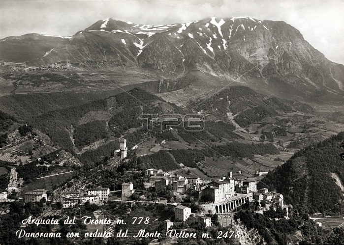
ARQUATA DEL TRONTO m. 778; panorama with views of Mount Carrier m. 2478. Town of Piceno with three bordering regions (Lazio; Umbria and Abruzzo); its territory is enclosed between two natural areas: the National Park of Gran Sasso and Monti della Laga to the south and the north of the Sibillini Mountains National Park. Note for the fortress that dominates the town and the native vine that produces wine Pecorino of Arquata del Tronto; in August of 2016 was the scene of a terrible earthquake; which produced the collapse or heavily damaged many buildings and caused 51 victims; of which 46 in only a fraction of Pescara del Tronto. Numerous aftershocks followed the main and further to the repetition of the earthquake on 26 and 30 October; which definitively destroyed the buildings; has created a fissure; a fault scarp over 15 km along the Mount Carrier from Arquata up to Ussita (MC) in which it is evident the sinking of the ground; from 20 to 70 cm according to the places; which affected the whole area. A witness to a landscape that does not meet again; and quotas that are no longer; remains this postcard of the 50s of XX century.
| px | px | dpi | = | cm | x | cm | = | MB |
Details
Creative#:
TOP20234509
Source:
達志影像
Authorization Type:
RM
Release Information:
須由TPG 完整授權
Model Release:
No
Property Release:
No
Right to Privacy:
No
Same folder images:
 Loading