
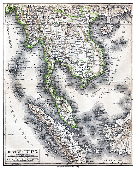
Physical map showing approximate political frontiers in Green. The Shan and Lao states are shown independent of (or tributary to) Siam. Chiang Mai ('Tshien-Mai'and Luang Prabang are both shown lying within the frontiers of a greater Siam;; but the territoryy of Chiang Mai extends further to the northwest; into Burma's Shan State; beyond the Salween River; than it does today.
Cambodia is much curtailed; with Angkor and Battambang part of Siam. Champa is still indicated in southern Vietnam ('Tshampa'); though it finally ceased to exist in 1832. The Lao kingdoms of Luang Prabang; Vientiane (Vien Tscan) and Champassak are all represented as part of Greater Siam. The Anglo-French competition for dominion over the region was just starting; and over the next 30 years Siam would lose much of its territory to the east and Northeast; as well as in the Malayan Peninsula.
| px | px | dpi | = | cm | x | cm | = | MB |
Details
Creative#:
TOP20184207
Source:
達志影像
Authorization Type:
RM
Release Information:
須由TPG 完整授權
Model Release:
No
Property Release:
No
Right to Privacy:
No
Same folder images:
 Loading