
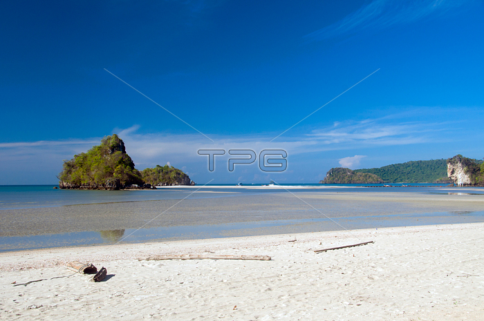
Hat Nopparat Thara is located about 18 kms north-west of Krabi Town. The beach used to be called Hat Khlong Haeng (Dry Canal Beach) because the canal that flows into the Andaman Sea here is dry except during; and just after; the monsoon season. Now it's called Hat Nopparat Thara; which when translated is quite beautiful - a Pali designation meaning 'Beach of the Nine-Gemmed Stream' with reference to the small canal that flows into the Andaman Sea at this point. It's around 2km long and forms part of the Hat Nopparat - Ko Phi Phi National Park; which has provided the area with some degree of protection against environmental degradation.
Krabi Province is made up of more than 5;000 sq km of jungle-covered hills and sharp; jagged karst outcrops; as well as more than 100km of luxuriant; pristine coastline and around 200 islands in the neighbouring Andaman Sea.
About 40 per cent of the provincial population is Muslim; the remainder being predominantly Buddhist. This is a clear indication that Krabi sits astride the invisible diving line between Buddhist Thailand and the four southern provinces鈥擲atun; Narathiwat; Yala and Pattani鈥攚hich are predominantly Muslim. Far from causing any sort of problem; this adds immensely to the cultural width and diversity of the province; blending mosques with temples; Malay cooking traditions with Thai cuisine; and giving the province a pleasantly relaxed multi-cultural feel.
| px | px | dpi | = | cm | x | cm | = | MB |
Details
Creative#:
TOP20152248
Source:
達志影像
Authorization Type:
RM
Release Information:
須由TPG 完整授權
Model Release:
No
Property Release:
No
Right to Privacy:
No
Same folder images:
 Loading