
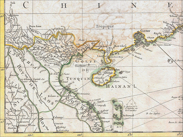
Carte Hydro-Geo-Graphique des Indes Orientales en deca et au dela du Gange avec leur Archipel Dressee et assujettie aux Observations Astronomiques; by cartographer Rigobert Bonne (1727-1795).
Bonne's 1771 map of Tonkin and the South China Sea / East Sea is important and controversial as it clearly shows Hainan Island (yellow outline) belonging to China and; more significantly; the Paracel Islands - currently disputed between China and Vietnam but occupied by the former - in green; as Vietnamese territory. The disputed Spratlys are not shown on the map.
In 1771 Tonkin was ruled by the Trinh Lords (1545-1787); specifically by the 10th Trinh Lord; Tr?nh S鈓 (Ruled 1767 - 1782 under the title Tinh Do Vuong).
| px | px | dpi | = | cm | x | cm | = | MB |
Details
Creative#:
TOP20138493
Source:
達志影像
Authorization Type:
RM
Release Information:
須由TPG 完整授權
Model Release:
No
Property Release:
No
Right to Privacy:
No
Same folder images:
 Loading