
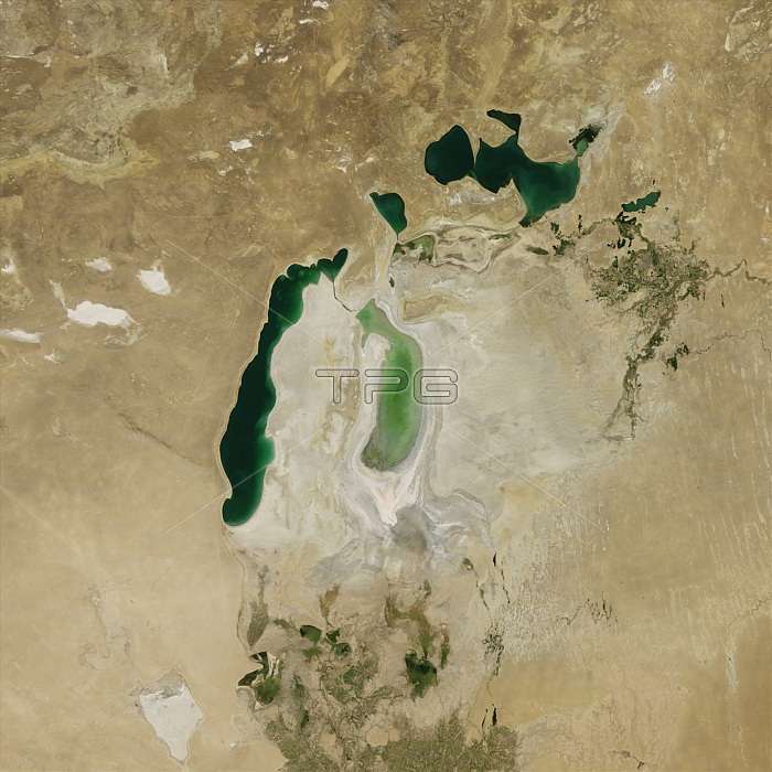
Satellite image of the shrinking of the Aral Sea taken in 2011. The Aral Sea, is a lake lying between Kazakhstan, in the north and Uzbekistan in the south. The name roughly translates as 'Sea of Islands', referring to over 1,100 islands that once dotted its waters; Formerly one of the four largest lakes in the world with an area of 68,000 km2 (26,300 sq mi), the Aral Sea has been steadily shrinking since the 1960s after the rivers that fed it were diverted by Soviet irrigation projects.
| px | px | dpi | = | cm | x | cm | = | MB |
Details
Creative#:
TOP20019511
Source:
達志影像
Authorization Type:
RM
Release Information:
須由TPG 完整授權
Model Release:
No
Property Release:
No
Right to Privacy:
No
Same folder images:
 Loading