
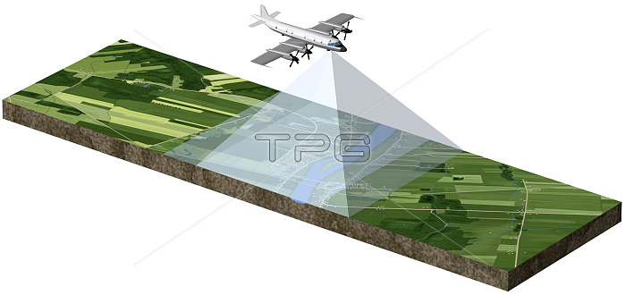
The geodetic network is a basic framework to which many other data must be added. Since the mid-20th century, surveys of these elements have usually been conducted using aerial photography. An airplane flies at a constant altitude, speed, and direction over the territory to be surveyed and takes pictures at regular intervals, with each image overlapping part of the preceding one. Using the overlapping parts of two successive photographs, the cartographer can view the territory in three dimensions with a stereoscope and thus get an indication of its relief features.
| px | px | dpi | = | cm | x | cm | = | MB |
Details
Creative#:
TOP19705873
Source:
達志影像
Authorization Type:
RM
Release Information:
須由TPG 完整授權
Model Release:
No
Property Release:
No
Right to Privacy:
No
Same folder images:
 Loading