
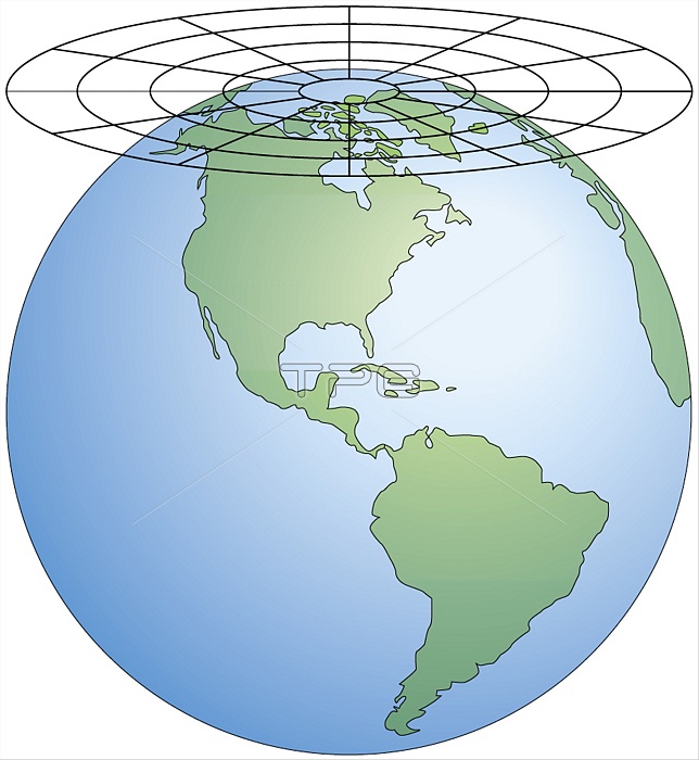
An azimuthal (or planar) projection is produced on a plane so placed that it is tangential to one point on the planetˇs surface. The map obtained is circular in shape and represents only one hemisphere. Because the distortion of shapes increases with distance from the tangent point, this type of projection is used mainly to portray polar regions.
| px | px | dpi | = | cm | x | cm | = | MB |
Details
Creative#:
TOP19705863
Source:
達志影像
Authorization Type:
RM
Release Information:
須由TPG 完整授權
Model Release:
No
Property Release:
No
Right to Privacy:
No
Same folder images:
 Loading