
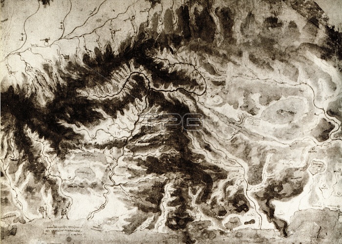
Uncannily like an aerial photograph, Leonardo's map of northern Italy, drawn about 1503, refers to his plans for constructing a canal connecting Florence with the sea. It shows the Tuscan region of the Apennines, with the Arno- Tiber watershed.
| px | px | dpi | = | cm | x | cm | = | MB |
Details
Creative#:
TOP19235455
Source:
達志影像
Authorization Type:
RM
Release Information:
須由TPG 完整授權
Model Release:
No
Property Release:
No
Right to Privacy:
No
Same folder images:
 Loading