
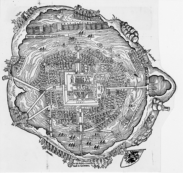
16th century plan of the island city of Mexico-Tenochtitlan, believed to have been drawn for Cortes (the plan is orientated with the east at the top)
| px | px | dpi | = | cm | x | cm | = | MB |
Details
Creative#:
TOP18413365
Source:
達志影像
Authorization Type:
RM
Release Information:
須由TPG 完整授權
Model Release:
No
Property Release:
No
Right to Privacy:
No
Same folder images:
 Loading