
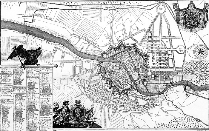
A plan of Berlin and its surroundings in 1737. The engraving shows (1) the Berlin State palace and (2) Monbijou - both of which were pulled down in 1945; (3) the Brandenburg Gate; (4) the Potsdam Gate. Potsdam is only twelve miles from Berlin. (Note that the plan is inverted, with North at the foot.)
| px | px | dpi | = | cm | x | cm | = | MB |
Details
Creative#:
TOP18412036
Source:
達志影像
Authorization Type:
RM
Release Information:
須由TPG 完整授權
Model Release:
No
Property Release:
No
Right to Privacy:
No
Same folder images:
 Loading