
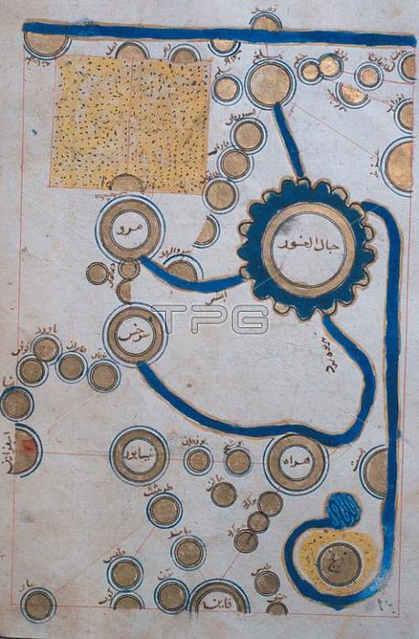
Geographie / Kartographie.- Landkarte nach dem arabische Geographen Ibn Hauqal (10. Jahrhundert).Aus einem arabischen Atlas.Ms Aya Sophia 2971;Istanbul; S黮eymaniye-Bibliothek.
| px | px | dpi | = | cm | x | cm | = | MB |
Details
Creative#:
TOP18175864
Source:
達志影像
Authorization Type:
RM
Release Information:
須由TPG 完整授權
Model Release:
No
Property Release:
No
Right to Privacy:
No
Same folder images:
10THCENTURY1STMILLENNIUMA.D.ARTATLASESBOOKILLUMINATIONBOOKILLUSTRATIONCARTOGRAPHYCDGEOGRAPHYIBNHAUQALILLUSTRATIONISLAMISLAMICWORLDISLAMICARTISLAMICCOUNTRIESIstanbulS黮eymaniye-BibliothekMAPMIDDLEAGESMINIATURE(PAINTING)ORIENTPAINTING(TECHNIQUE)PORTRAITFORMATRIVERROLANDANDSABRINAMICHAUDROLANDMICHAUDSABRINAMICHAUDTOPOGRAPHYWATERSBODIESOFWATER
(PAINTING)(TECHNIQUE)10TH1STA.D.AGESANDARTARTATLASESBODIESBOOKBOOKCARTOGRAPHYCDCENTURYCOUNTRIESFORMATGEOGRAPHYHAUQALIBNILLUMINATIONILLUSTRATIONILLUSTRATIONISLAMISLAMICISLAMICISLAMICIstanbulMAPMICHAUDMICHAUDMICHAUDMIDDLEMILLENNIUMMINIATUREOFORIENTPAINTINGPORTRAITRIVERROLANDROLANDSABRINASABRINAS黮eymaniye-BibliothekTOPOGRAPHYWATERWATERSWORLD
 Loading