
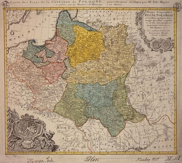
Polen / Landkarten:- "Mappa Geographica REGNI POLONIAE (鈥? ". (Karte des K枚nigreichs Polen unter August dem Starken mit Litauen; Wei脽ru脽land und westl. Ukraine).Kupferstich; mit Grenz und Fl盲chenkolorit; nach Zeichnung von Tobias Mayer.45;5 x 53 cm.N眉rnberg (Joh. Bapt. Homann Erben) 1750.Berlin; Museum f眉r Kommunikation.
| px | px | dpi | = | cm | x | cm | = | MB |
Details
Creative#:
TOP17215304
Source:
達志影像
Authorization Type:
RM
Release Information:
須由TPG 完整授權
Model Release:
No
Property Release:
No
Right to Privacy:
No
Same folder images:
 Loading