
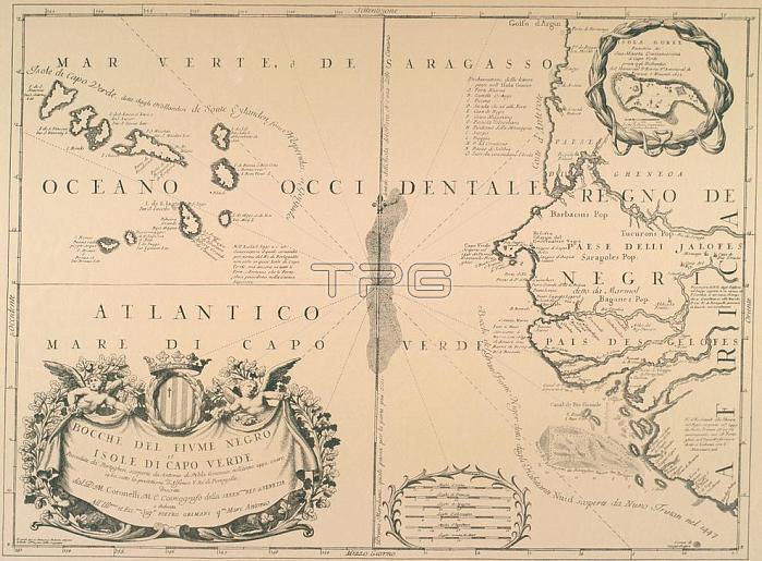
Cape Verde Islands / - "BOCCHE DEL FIUME NEGRO et ISOLE DI CAPO VERDE".Map of the Cape Verde Islands and parts of West Africa (Cap-Vert peninsula and mouth of the River Senegal). Smaller map: Gor閑. / Copper engraving after after drawing by Vincenzo Coronelli(1650-1718). From: Corso geografico universale; Venice 1692-94.
| px | px | dpi | = | cm | x | cm | = | MB |
Details
Creative#:
TOP17103453
Source:
達志影像
Authorization Type:
RM
Release Information:
須由TPG 完整授權
Model Release:
No
Property Release:
No
Right to Privacy:
No
Same folder images:
 Loading