
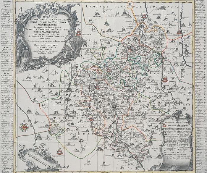
Saxony (Germany) / Maps."DYNASTIAE COMITAT (ORUM) SCHOENBURGICI (..) Geographica delineatione (鈥? ".(Map showing lands owned by the House of Sch枚nburg in Saxony).Engraving; with coloured borders; by Tobias Konrad Lotter (1717-1777).plate 51 x 60 cm.Augsburg (Germany) (Matth盲us Seutter) circa 1750.
| px | px | dpi | = | cm | x | cm | = | MB |
Details
Creative#:
TOP17040030
Source:
達志影像
Authorization Type:
RM
Release Information:
須由TPG 完整授權
Model Release:
No
Property Release:
No
Right to Privacy:
No
Same folder images:
 Loading