
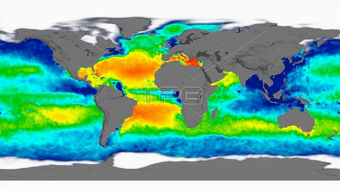
Sea surface salinity, April 2012 global map. The salinity (salt content) of the sea surface, used in climate models, depends on sea surface temperature and evaporation, winds, and fresh water from rivers, rain, and melting ice. The colour-coding gives the salinity range in PSU (practical salinity units, equivalent to parts per thousand) from 30 (blue) to 35 (green) to 40 (red). Average salinity is 35 PSU, with the normal range from 33 to 37 PSU. The Atlantic Ocean (centre) and Mediterranean Sea are highly saline. The Pacific and Indian oceans are less saline. This data was acquired by the Aquarius instrument on the joint Argentine-NASA SAC-D satellite.
| px | px | dpi | = | cm | x | cm | = | MB |
Details
Creative#:
TOP16633907
Source:
達志影像
Authorization Type:
RM
Release Information:
須由TPG 完整授權
Model Release:
N/A
Property Release:
N/A
Right to Privacy:
No
Same folder images:
 Loading