
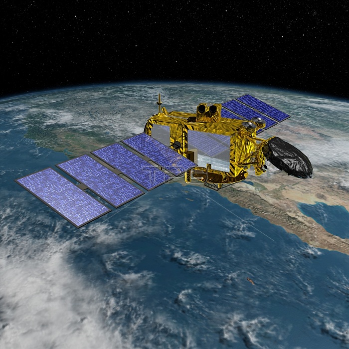
Jason-3 satellite. Computer artwork of the Jason-3 Ocean Surface Topography Mission (OSTM) satellite in Earth orbit. OSTM is an international Earth observation satellite mission that uses an array of instruments to map ocean surface topography to a high degree of accuracy. This allows global monitoring of tides, ocean currents and oscillations, ocean circulation, and climate change-induced rises in sea levels. Jason-3, scheduled for launch in 2015, will be the fourth spacecraft to be part of the OSTM, which was begun in 1992 by the joint NASA/CNES TOPEX/Poseidon mission and followed by the NASA/CNES Jason-1 (2001) and Jason-2 (2008) missions.
| px | px | dpi | = | cm | x | cm | = | MB |
Details
Creative#:
TOP16633001
Source:
達志影像
Authorization Type:
RM
Release Information:
須由TPG 完整授權
Model Release:
N/A
Property Release:
N/A
Right to Privacy:
No
Same folder images:
 Loading