
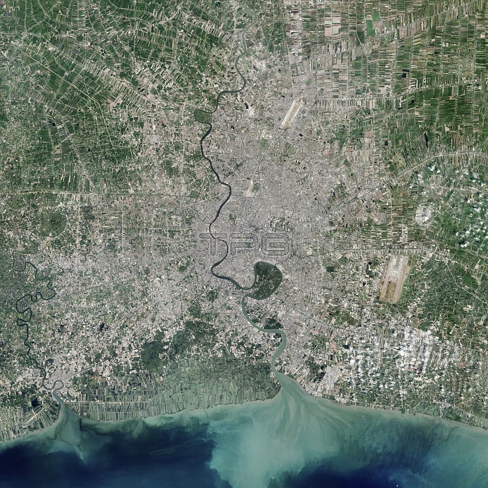
Bangkok, Thailand. Satellite image centred on Bangkok, the capital city of Thailand, showing the Bang Kachao conservation area (dark, lower centre) surrounded by an old meander of the Chao Phraya River (dark line, vertical). Bang Kachao is a lush protected area that has escaped the dense development seen elsewhere in Bangkok. The Bay of Bangkok (Bight of Bangkok, bottom) and Suvarnabhumi airport (rectangular, lower centre-right) can also be seen. Imaged by the Operational Land Imager (OLI) onboard the Landsat 8 satellite.
| px | px | dpi | = | cm | x | cm | = | MB |
Details
Creative#:
TOP16631877
Source:
達志影像
Authorization Type:
RM
Release Information:
須由TPG 完整授權
Model Release:
N/A
Property Release:
N/A
Right to Privacy:
No
Same folder images:
201521stcentury27july27/06/201527thalluvialplainbangkachaobangkrajaobangkrachaobangkokbayofbangkokbendbightofbangkokcapitalcitychaophrayarivercoastcoastalconservationareaearthobservationfromspacegeographicalgulfofthailandlandformlandsat8satellitemeanderno-onenobodyolioperationallandimagerphysicalgeographyprotectedregionregionriversouthchinaseasouth-eastasiansoutheastasiasuvarnabhumiairporturbanurbanisationwater
827201521st27/06/201527thairportalluvialareaasiaasianbangbangbangbangkokbangkokbangkokbaybendbightcapitalcenturychaochinacitycoastcoastalconservationearthfromgeographicalgeographygulfimagerjaojulykachaokrakrachaolandlandformlandsatmeanderno-onenobodyobservationofofofolioperationalphrayaphysicalplainprotectedregionregionriverriversatelliteseasouthsouth-eastsoutheastspacesuvarnabhumithailandurbanurbanisationwater
 Loading