
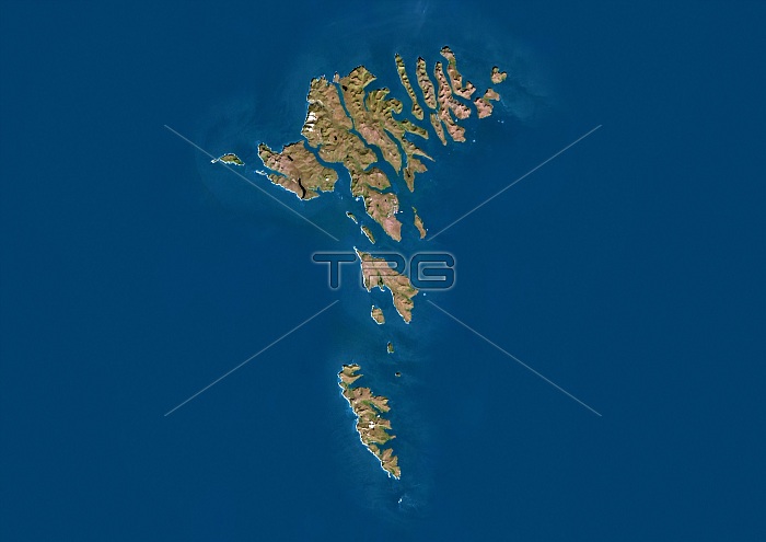
Faroe Islands, Denmark. Satellite image of the Faroe Islands (green) that lie between the Norwegian Sea (blue, right) and the North Atlantic Ocean (blue, left). The Faroe Islands are a self-governing country within the Kingdom of Denmark.
| px | px | dpi | = | cm | x | cm | = | MB |
Details
Creative#:
TOP16630940
Source:
達志影像
Authorization Type:
RM
Release Information:
須由TPG 完整授權
Model Release:
N/A
Property Release:
N/A
Right to Privacy:
No
Same folder images:
21stcenturyarchipelagoself-governingborderbordersboundariesboundarycartographycoastcoastalcountriescountrydanishdanishrealmearthobservationenvironmentenvironmentalscienceeuropeeuropeanfaroeislandsfromabovefromspacefrontierfrontiersgeographicalgeographyislandkingdomofdenmarklandmapno-onenobodynorthatlanticoceannorthseasatelliteimagescandinaviascandinavian
21stabovearchipelagoatlanticborderbordersboundariesboundarycartographycenturycoastcoastalcountriescountrydanishdanishdenmarkearthenvironmentenvironmentaleuropeeuropeanfaroefromfromfrontierfrontiersgeographicalgeographyimageislandislandskingdomlandmapno-onenobodynorthnorthobservationoceanofrealmsatellitescandinaviascandinavianscienceseaself-governingspace
 Loading