
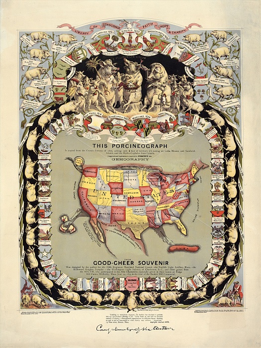
Pig-shaped map of the USA. 19th-century pig-shaped map ('porcineograph') of the United States of America. Pigs represent the US states and territories, labelled with pork-related foods and the year they joined the Union (those without dates had not yet joined). The Indian Territory is what is now Oklahoma. The Sandwich Islands are what is now Hawaii. Published by Forbes Lithograph Manufacturing Company in Boston in around 1876, it was designed for military veterans at a 'fete champetre' held on 19 June 1875 at Ridge Hill Farms, Massachusetts, USA, to celebrate the centennial of the battle of Bunker Hill in the American Revolutionary War.
| px | px | dpi | = | cm | x | cm | = | MB |
Details
Creative#:
TOP16628246
Source:
達志影像
Authorization Type:
RM
Release Information:
須由TPG 完整授權
Model Release:
N/A
Property Release:
N/A
Right to Privacy:
No
Same folder images:
 Loading