
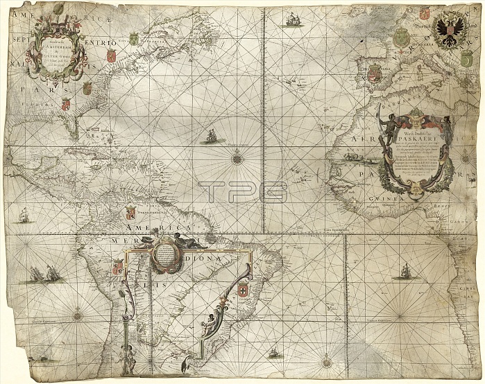
Map of the Atlantic coasts. 17th-century map of the Atlantic Ocean and its coastlines, produced in 1660 by Dutch cartographer Pieter Goos (1616-1675). The title ('West-Indische paskaert', centre right) refers to the territorial holdings of the Dutch West India Company (founded 1621). The rhumb lines and naming of rivers and ports along the coastlines makes this a portolan navigational chart. Southern South America is shown in an inset at lower left. Dutch text (upper left) names the map-maker and the city of publication (Amsterdam). Overseas territories are marked by European coats-of-arms: Spanish, Dutch, French, English, Portuguese.
| px | px | dpi | = | cm | x | cm | = | MB |
Details
Creative#:
TOP16426655
Source:
達志影像
Authorization Type:
RM
Release Information:
須由TPG 完整授權
Model Release:
N/A
Property Release:
N/A
Right to Privacy:
No
Same folder images:
 Loading