
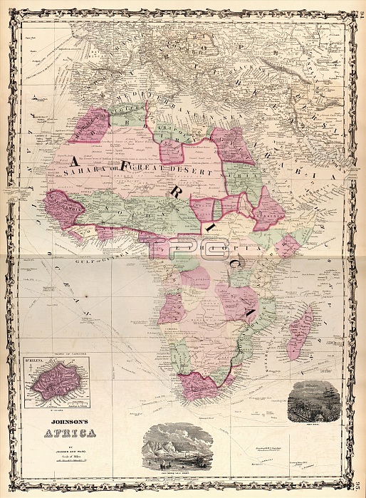
Map of Africa. 19th-century map of the continent of Africa, published in 1862 by US cartographer Alvin Jewett Johnson (1827-1884). Explorers named on the map include Lander, Denham and Clapperton, Park, Caillie, Allen and Oldfield, D'Arnaud and Sabatier, and Mahamet Ali (Muhammad Ali of Egypt). Routes of navigators named on the oceans are: James Cook, Vasco da Gama, George Vancouver, Samuel Wallis, John Byron, and Philip Carteret. The insets across bottom show (left to right): the island of Saint Helena, Cape Town and Table Mountain, and Port Natal. Map published in 'Johnson's New Illustrated Family Atlas' (New York, 1862).
| px | px | dpi | = | cm | x | cm | = | MB |
Details
Creative#:
TOP16426649
Source:
達志影像
Authorization Type:
RM
Release Information:
須由TPG 完整授權
Model Release:
N/A
Property Release:
N/A
Right to Privacy:
No
Same folder images:
 Loading