
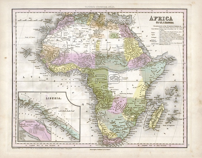
Map of Africa. 19th-century map of the continent of Africa, published in 1844 by US cartographer Henry Schenck Tanner (1786-1858). The coast and inland regions of Africa and major rivers were mapped, but large areas of the interior (white areas in central Africa and the Sahara) remained unknown until the second half of the 19th century. By the 1840s, the continent had begun to be divided up by European powers (colonies and territories listed at top right). Liberia (founded by US colonists in 1822) is shown in inset at bottom left with a further inset of its capital Monrovia. Published in 'A New Universal Atlas' (Philadelphia, 1844).
| px | px | dpi | = | cm | x | cm | = | MB |
Details
Creative#:
TOP16426643
Source:
達志影像
Authorization Type:
RM
Release Information:
須由TPG 完整授權
Model Release:
N/A
Property Release:
N/A
Right to Privacy:
No
Same folder images:
 Loading