
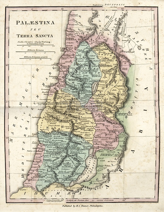
Map of Ancient Palestine, 19th century. This map of Palestine during the Roman Empire, also titled 'The Holy Land' in Latin, is divided by colour into regions such as Syrophoenicia (the Phoenicians), Galilee, Iturea, Samaria, Peraea, Allophyli (the Philistines), Judaea, and Moab (the Moabites). Also named are the territories of Idumea (which included Edom, bottom) and of the Ammonites, and Coele-Syria and Arabia. The Dead Sea and Sea of Galilee are both shown. The distance scales (upper left) are in Greek stadia, Roman miles, and British miles. Published in 'An Atlas of Ancient Geography' (1826) by US cartographer Henry Schenck Tanner (1786-1858).
| px | px | dpi | = | cm | x | cm | = | MB |
Details
Creative#:
TOP16426060
Source:
達志影像
Authorization Type:
RM
Release Information:
須由TPG 完整授權
Model Release:
N/A
Property Release:
N/A
Right to Privacy:
No
Same folder images:
 Loading