
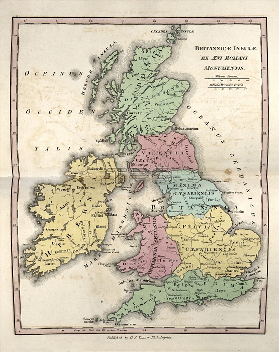
Map of Ancient Britannia, 19th century. This map is divided by colour into regions such as Caledonia (green, Scotland) and Hibernia (yellow, Ireland). Roman Britain is shown as it was at the end of the 3rd century at the time of the Diocletian Reforms. Britannia was split into Valentia (pink), Maxima Caesariensis (blue), Flavia Caesariensis (yellow), Britannia Secunda (pink), and Britannia Prima (green). The exact borders and nature of these late Roman provinces are disputed by historians. The distance scales are in Roman miles and British miles. Published in 'An Atlas of Ancient Geography' (1826) by US cartographer Henry Schenck Tanner (1786-1858).
| px | px | dpi | = | cm | x | cm | = | MB |
Details
Creative#:
TOP16426059
Source:
達志影像
Authorization Type:
RM
Release Information:
須由TPG 完整授權
Model Release:
N/A
Property Release:
N/A
Right to Privacy:
No
Same folder images:
 Loading