
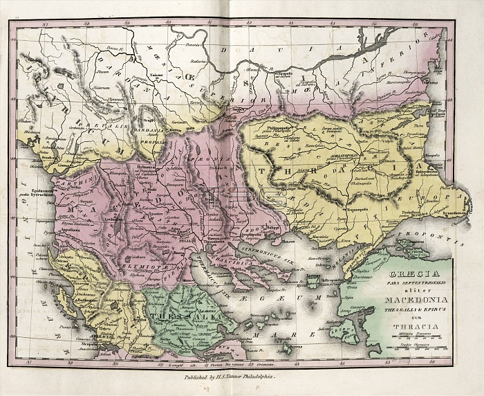
Map of Ancient North Greece, 19th century. This map, corresponding roughly to the Balkans, is divided by colour into regions such as Epirus (yellow), Thessaly (green), Macedonia (pink) and Thracia (yellow). At lower right is the Greek island of Lesbos and the Turkish mainland (green), then known as Asia Minor. The Ionian Sea is at left, and the Aegean Sea at right. Non-coloured areas to the north are Illyria, Dardania, Dacia, Moesia Superior and Moesia Inferior. The distance scales (lower right) are in Roman miles and Greek stadia. Published in 'An Atlas of Ancient Geography' (1826) by US cartographer Henry Schenck Tanner (1786-1858).
| px | px | dpi | = | cm | x | cm | = | MB |
Details
Creative#:
TOP16426057
Source:
達志影像
Authorization Type:
RM
Release Information:
須由TPG 完整授權
Model Release:
N/A
Property Release:
N/A
Right to Privacy:
No
Same folder images:
 Loading