
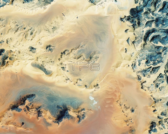
Algerian Sahara. Satellite image of rock outcrops and sandy areas in a region of the Sahara in Algeria. The Sahara is the world's largest desert. The Sahara is shaped by the wind, heat and aridity, and includes sand dunes, stone plateaus and mountains, gravel plains, dry valleys, dry lakes, and salt flats. Image obtained on 22 March 2011 by the GeoEye-1 satellite, which orbits at a height of 680 kilometres.
| px | px | dpi | = | cm | x | cm | = | MB |
Details
Creative#:
TOP16424797
Source:
達志影像
Authorization Type:
RM
Release Information:
須由TPG 完整授權
Model Release:
N/A
Property Release:
N/A
Right to Privacy:
No
Same folder images:
 Loading