
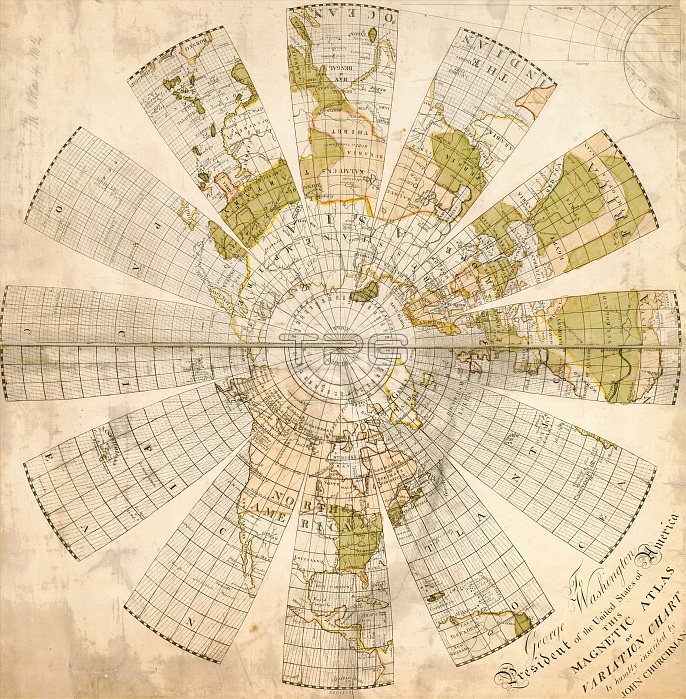
18th century map of the Northern Hemisphere with a dedication to George Washington, president of the USA. This is a magnetic atlas, or variation chart, that allows the magnetic variation of any location to be determined. The magnetic variation is the difference between true north and magnetic north, which varies with location and time. The map was drawn by the surveyor John Churchman (1753-1805) and first printed in 1790.
| px | px | dpi | = | cm | x | cm | = | MB |
Details
Creative#:
TOP16412798
Source:
達志影像
Authorization Type:
RM
Release Information:
須由TPG 完整授權
Model Release:
N/A
Property Release:
N/A
Right to Privacy:
No
Same folder images:
 Loading