
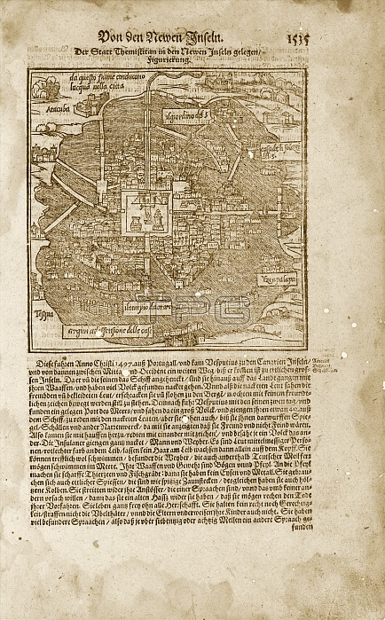
Mexico City. 16th-century printed text and map of Mexico City-Tenochtitlan, the capital of the Aztec Empire. This city was built on an island in the centre of Lake Texcoco in the Valley of Mexico. The city was connected to the surrounding areas by several causeways. It was conquered by the Spanish (led by Cortes) in 1521. The areas around the city are named in the labels, with Iztapalapa at right. The area of Tacuba ('Atacuba') is labelled at top left. The area of Tesgua is labelled at lower left. A sacrificial temple is at centre. This map and the German text are from 'Cosmographia Universalis' (1597) by German cartographer Sebastian Munster (1489-1552).
| px | px | dpi | = | cm | x | cm | = | MB |
Details
Creative#:
TOP16313551
Source:
達志影像
Authorization Type:
RM
Release Information:
須由TPG 完整授權
Model Release:
N/A
Property Release:
N/A
Right to Privacy:
No
Same folder images:
 Loading