
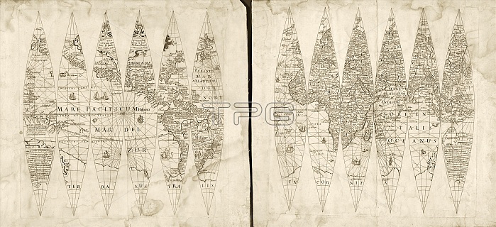
Hondius map gores. 17th-century set of 12 map gores showing the geography of the Earth according to Dutch cartographer Jodocus Hondius (1563-1612). The gores are designed to be assembled into a globe. The labels and text are in Latin. The Pacific Ocean is named as both 'Mare Pacificum' and 'Mar del Zur'. The Atlantic Ocean is named as 'Oceanus Atlanticus' and 'Mar del Norte'. The Indian Ocean is named as 'Orientalis Oceanus'. Across bottom, the unknown southern continent is labelled 'Terra Australis Incognita'. The gores include a dedication at upper left, with the text at lower right naming Hondius as the map-maker. Published in Milan in 1615.
| px | px | dpi | = | cm | x | cm | = | MB |
Details
Creative#:
TOP16313548
Source:
達志影像
Authorization Type:
RM
Release Information:
須由TPG 完整授權
Model Release:
N/A
Property Release:
N/A
Right to Privacy:
No
Same folder images:
 Loading