
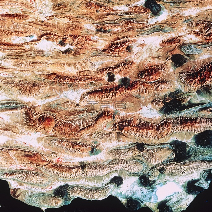
Zagros mountains. Coloured LANDSAT satellite image of the Zagros mountain range in the region of the town of Bastak, southern Iran. North is at top. Green vegetation is coloured red. The geology is dominated by the folded Zagros mountains running in lines as ridges of resistant rock etched by erosion. The Zagros mountains form an important section in a long chain of mountains stretching from the Atlantic to Indonesia. They are typical of a destructive tectonic plate boun- dary. Dark patches are past larva flows from fissures. At bottom is the Persian Gulf (black). Bastak is not visible. Photographed in February.
| px | px | dpi | = | cm | x | cm | = | MB |
Details
Creative#:
TOP16235498
Source:
達志影像
Authorization Type:
RM
Release Information:
須由TPG 完整授權
Model Release:
N/A
Property Release:
N/A
Right to Privacy:
No
Same folder images:
 Loading