
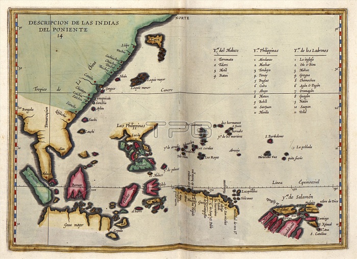
East Indies. 17th-century map of the East Indies and the islands of South-East Asia. The East Indies were the lands discovered by European explorers travelling east to the lands beyond India and China. Islands listed at upper right are the Moluccas, the Philippines, and the Ladrones (Mariana Islands). Other places include Sumatra, Java, Borneo, Japan, the Celebes, New Guinea and the Solomon Islands. This map is from 'Descriptio Indiae Occidentale' in 'Nieuwe werelt' (1622), a Dutch republication of an earlier 1601 work by Spanish historian Antonio de Herrera y Tordesillas (1549-1626). This Dutch edition was published in Amsterdam by Michiel Colijn.
| px | px | dpi | = | cm | x | cm | = | MB |
Details
Creative#:
TOP16235329
Source:
達志影像
Authorization Type:
RM
Release Information:
須由TPG 完整授權
Model Release:
N/A
Property Release:
N/A
Right to Privacy:
No
Same folder images:
 Loading