
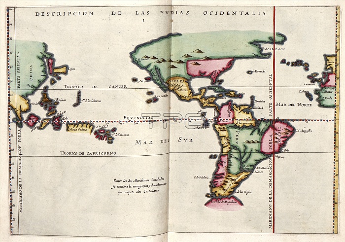
East and West Indies. 17th-century map of the East Indies and the West Indies. The West Indies was the term used to refer to the lands discovered by Columbus and other European explorers travelling west to what became known as the New World or the Americas. The East Indies were the lands discovered earlier by European explorers travelling east to the lands beyond India and China. This map is from 'Descriptio Indiae Occidentale' in 'Nieuwe werelt' (1622), a Dutch republication of an earlier 1601 work (see C028/4363) by Spanish historian Antonio de Herrera y Tordesillas (1549-1626). This Dutch edition was published in Amsterdam by Michiel Colijn.
| px | px | dpi | = | cm | x | cm | = | MB |
Details
Creative#:
TOP16235327
Source:
達志影像
Authorization Type:
RM
Release Information:
須由TPG 完整授權
Model Release:
N/A
Property Release:
N/A
Right to Privacy:
No
Same folder images:
 Loading