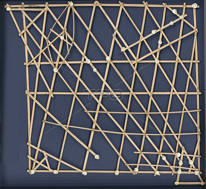
Rebbelib stick map, Marshall Islands. Rebbelib stick charts are used by Pacific islanders to record waves and currents around atolls and island groups. The Marshall Islands are in the western Pacific, where travel at sea takes place in outrigger sailing canoes. This chart indicates sailing directions for atolls and islands in the Ratak (eastern) and Ralik (western) chains of the Marshall Islands. Seashells depict the atoll and island locations. Each straight stick represents regular currents or waves around the low-lying atolls while the curved sticks depict ocean swells around the islands and at sea between the islands. This specimen of a stick map dates from the 1920s.
| px | px | dpi | = | cm | x | cm | = | MB |
Details
Creative#:
TOP16235309
Source:
達志影像
Authorization Type:
RM
Release Information:
須由TPG 完整授權
Model Release:
N/A
Property Release:
N/A
Right to Privacy:
No
Same folder images:

 Loading