
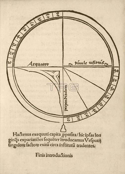
Navigational quadrant. 16th-century illustration of a quadrant used to measure angles and used in geography, astronomy and navigation. The sectors are labelled with 90 degrees, which here is the latitude on the Earth or celestial sphere. The Latin labels refer to the equator (left), the quadrant sights (right) and the plumb-line (lower centre). Diagram from 'Cosmographiae introductio' (1507), printed to accompany the globe and world map produced by German cartographer Martin Waldseemuller (c.1470-1520). They contained the first use of the name America to refer to the New World, honouring the supposed discoverer of the continent, Amerigo Vespucci.
| px | px | dpi | = | cm | x | cm | = | MB |
Details
Creative#:
TOP16234908
Source:
達志影像
Authorization Type:
RM
Release Information:
須由TPG 完整授權
Model Release:
N/A
Property Release:
N/A
Right to Privacy:
No
Same folder images:
 Loading