
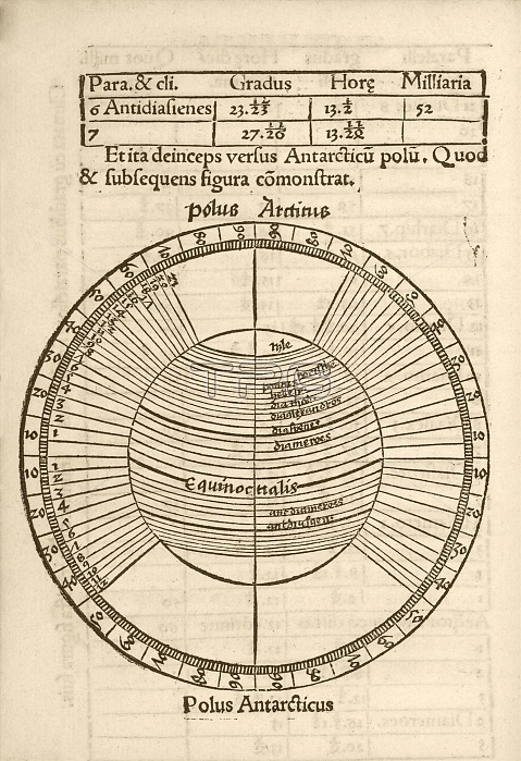
Parallels on Earth globe. 16th-century diagram of the parallels (lines of latitude) on an Earth globe, showing the Equator and the Arctic and Antarctic poles, and bands called 'climates'. At top are figures for the anti-climate for Syene (Aswan in Egypt). This diagram is from 'Cosmographiae introductio' (1507), printed to accompany the globe and world map produced in 1507 by German cartographer Martin Waldseemuller (c.1470-1520). This 1507 map and booklet contained the first use of the name America to refer to the New World, proposed in honour of the supposed discoverer of the continent, Amerigo Vespucci. The text is in Latin.
| px | px | dpi | = | cm | x | cm | = | MB |
Details
Creative#:
TOP16234905
Source:
達志影像
Authorization Type:
RM
Release Information:
須由TPG 完整授權
Model Release:
N/A
Property Release:
N/A
Right to Privacy:
No
Same folder images:
 Loading