
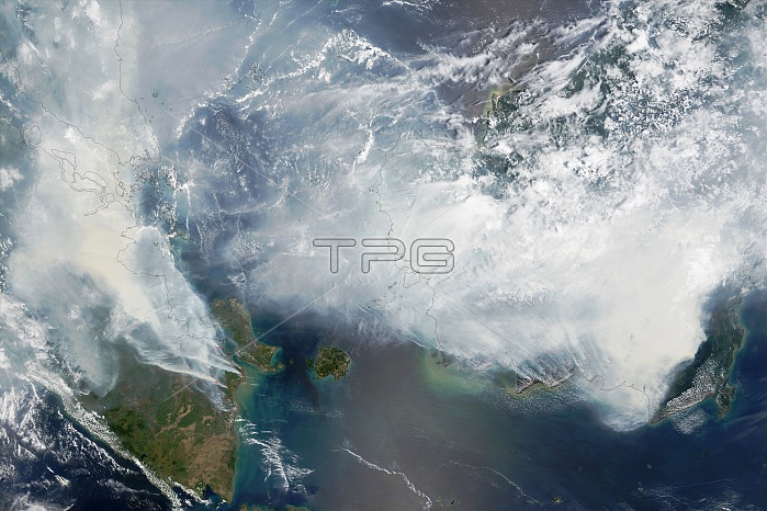
Satellite image of smoke from forest fires over Sumatra (left) and Borneo (right). Red areas are hotspots, and most likely fires. The fires are a result of illegal slash-and-burn agriculture in the region. They are exasperated by peat deposits that act as fuel and a prolonged dry season that has delayed the rain that usually extinguishes them. As well as destroying forests and releasing large quantities of carbon dioxide into the atmosphere, the air pollution causes respiratory illnesses and death. Image obtained on 24th September 2015 by the MODIS (Moderate Resolution Imaging Spectroradiometer) on NASA's Terra satellite.
| px | px | dpi | = | cm | x | cm | = | MB |
Details
Creative#:
TOP16234772
Source:
達志影像
Authorization Type:
RM
Release Information:
須由TPG 完整授權
Model Release:
N/A
Property Release:
N/A
Right to Privacy:
No
Same folder images:
 Loading