
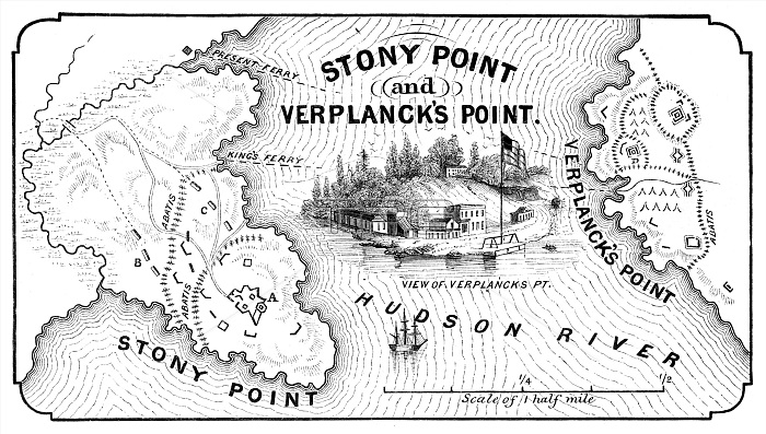
STONY POINT MAP, 1779. Map of Stony Point and Verplanck's Point on the Hudson River, held and fortified by the British from late May 1779 till they were captured by American troops led by Anthony Wayne, 16 July 1779. Wood engraving, American, 1852.
| px | px | dpi | = | cm | x | cm | = | MB |
Details
Creative#:
TOP16168958
Source:
達志影像
Authorization Type:
RM
Release Information:
須由TPG 完整授權
Model Release:
No
Property Release:
No
Right to Privacy:
No
Same folder images:
 Loading