
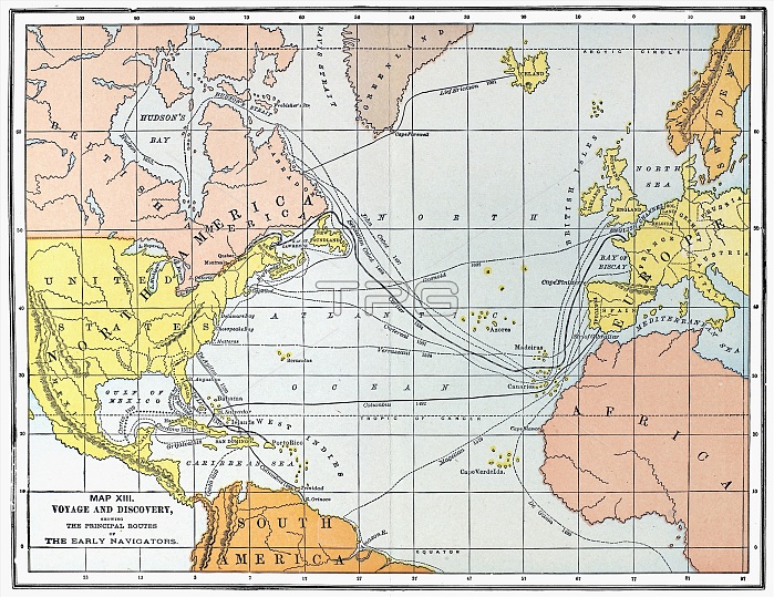
MAP: ATLANTIC VOYAGES. /nMap showing the routes of the major European voyages of discovery, from Leif Ericsson (1001) to Henry Hudson (1610).
| px | px | dpi | = | cm | x | cm | = | MB |
Details
Creative#:
TOP16165517
Source:
達志影像
Authorization Type:
RM
Release Information:
須由TPG 完整授權
Model Release:
No
Property Release:
No
Right to Privacy:
No
Same folder images:
11thCentury15thCentury16thCenturyAfricaAgeOfDiscoveryAtlanticOceanBartholomewCabotCaribbeanCaribbeanSeaChristopherColumbusCortCortesCorterealDaDeDiscoverDutchEnglishErickssonEuropeExteriorGamaGiovanniGosnoldHernandoJohnLeifMapMedievalNewWorldNorthAmericaRiverRouteSailingShipSebastianSouthAmericaSpanishVascoVerrazzanoVikingVoyage
11th15th16thAfricaAgeAmericaAmericaAtlanticBartholomewCabotCaribbeanCaribbeanCenturyCenturyCenturyChristopherColumbusCortCorterealCortesDaDeDiscoverDiscoveryDutchEnglishErickssonEuropeExteriorGamaGiovanniGosnoldHernandoJohnLeifMapMedievalNewNorthOceanOfRiverRouteSailingSeaSebastianShipSouthSpanishVascoVerrazzanoVikingVoyageWorld
 Loading