
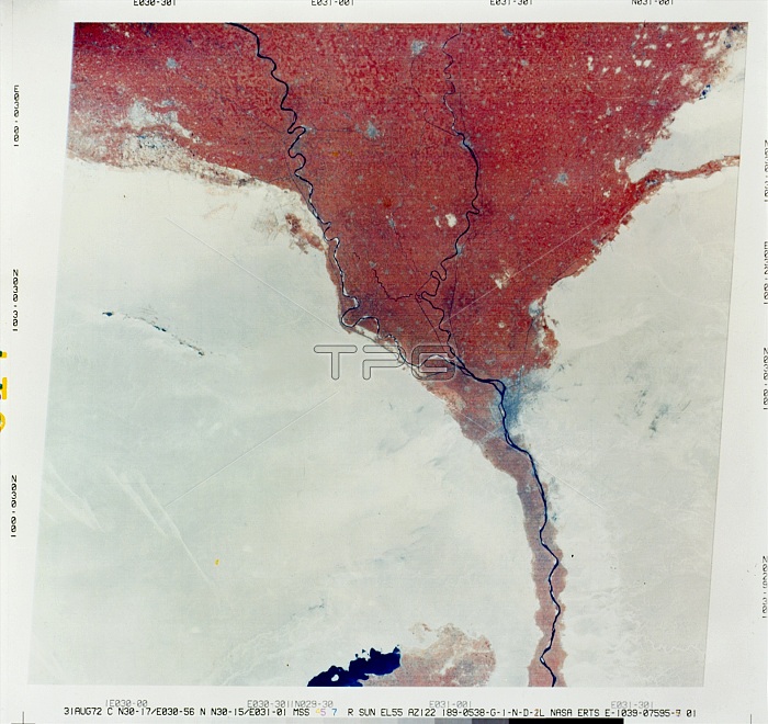
EARTH FROM SPACE, 1972. A view from space of the Nile River flowing through Cairo, Egypt (right center), and the surrounding region, with areas of vegetation shown in bright red. Part of Lake Qarun appears at bottom center. Composite of photographs taken by NASA's Earth Resources Technology Satellite-1 (ERTS-1, later renamed Landsat 1), 31 August 1972.
| px | px | dpi | = | cm | x | cm | = | MB |
Details
Creative#:
TOP16149240
Source:
達志影像
Authorization Type:
RM
Release Information:
須由TPG 完整授權
Model Release:
No
Property Release:
No
Right to Privacy:
No
Same folder images:
 Loading