
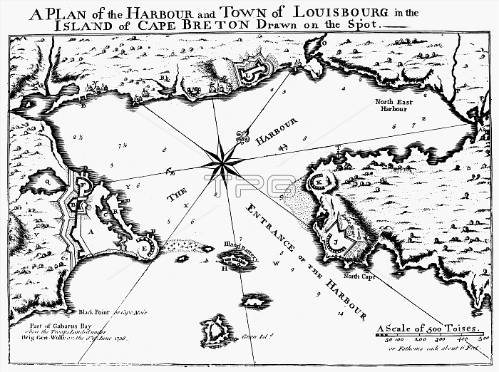
MAP: LOUISBOURG, 1758. /nMap of the harbor and fortifications at Louisbourg on Cape Breton Island, Nova Scotia. Line engraving, English, 1758.
| px | px | dpi | = | cm | x | cm | = | MB |
Details
Creative#:
TOP16140143
Source:
達志影像
Authorization Type:
RM
Release Information:
須由TPG 完整授權
Model Release:
No
Property Release:
No
Right to Privacy:
No
Same folder images:
 Loading