
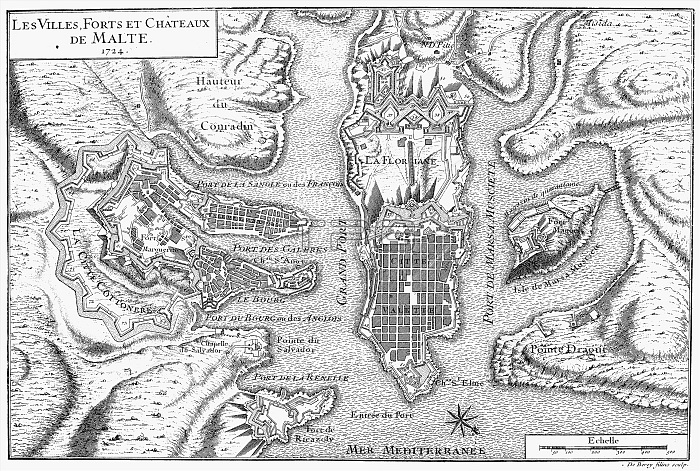
MALTA: VALETTA MAP, 1724. /nPlan of the city and harbor of Valletta and environs, showing the fortifications existing in 1724. Copper engraving, French, 1728.
| px | px | dpi | = | cm | x | cm | = | MB |
Details
Creative#:
TOP16129040
Source:
達志影像
Authorization Type:
RM
Release Information:
須由TPG 完整授權
Model Release:
No
Property Release:
No
Right to Privacy:
No
Same folder images:
 Loading