
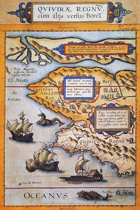
BERING STRAIT MAP, 1593. /nCornelis de Jode's 1593 map of Western North America showing the fabled province of Quivira in California and the Bering Strait (El Streto de Anian); depicted also are two sea monsters, two European sailing ships, and a large Oriental sailing galley.
| px | px | dpi | = | cm | x | cm | = | MB |
Details
Creative#:
TOP16100174
Source:
達志影像
Authorization Type:
RM
Release Information:
須由TPG 完整授權
Model Release:
No
Property Release:
No
Right to Privacy:
No
Same folder images:
 Loading