
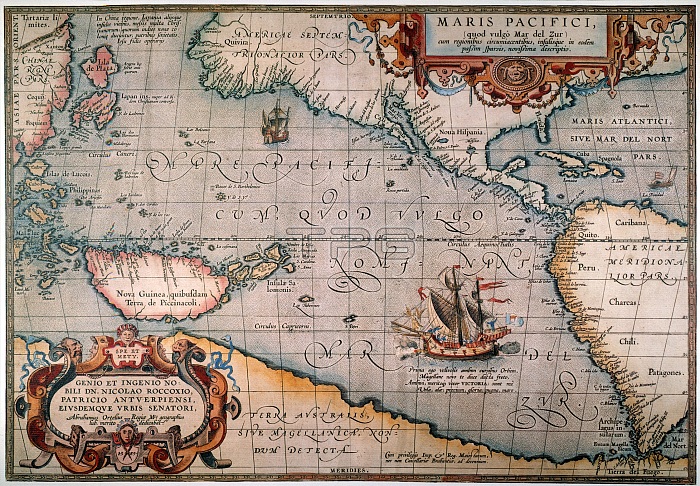
PACIFIC OCEAN MAP, 1589./nAbraham Ortelius' map of the Pacific Ocean, 1589, showing Ferdinand Magellan's ship "Victoria" sailing westward on the first voyage around the world.
| px | px | dpi | = | cm | x | cm | = | MB |
Details
Creative#:
TOP16099957
Source:
達志影像
Authorization Type:
RM
Release Information:
須由TPG 完整授權
Model Release:
No
Property Release:
No
Right to Privacy:
No
Same folder images:
 Loading