
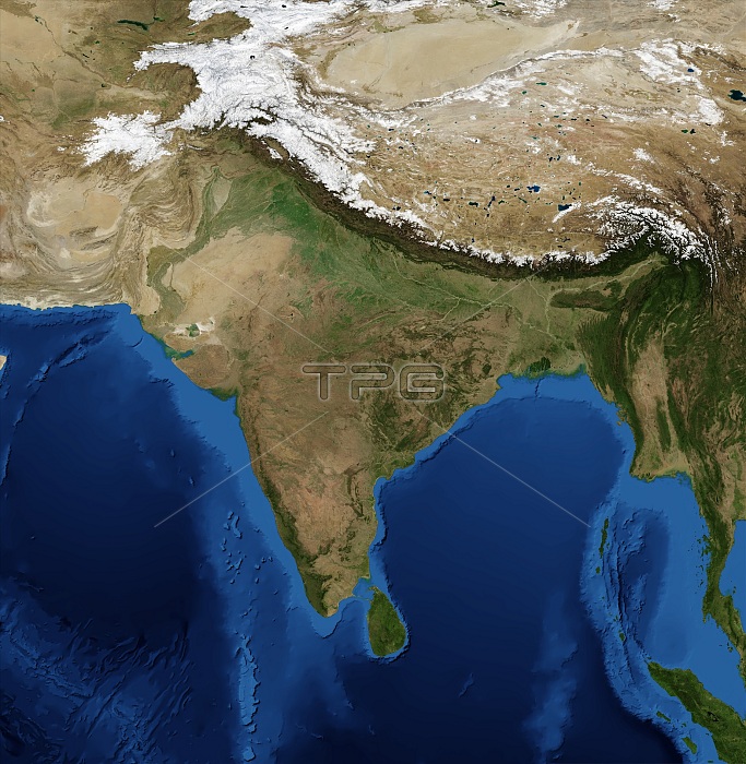
India. Blue Marble: Next Generation cloud-free topographic and bathymetric map of India and surrounding countries in July 2004. China is at top right. Highlands and lowlands are shown as ridges and flat areas. Snow on the Himalaya mountains is white. The seabed depth varies from shallow (light blue) on the continental shelves, to deep ocean basins (dark blue). Topographic and bathymetric data is usually gathered by using aerial and satellite imagery combined with radar and sonar mapping. Landcover data is from NASA's Moderate Resolution Imaging Spectroradiometer (MODIS) sensor aboard the Terra satellite.
| px | px | dpi | = | cm | x | cm | = | MB |
Details
Creative#:
TOP16085437
Source:
達志影像
Authorization Type:
RM
Release Information:
須由TPG 完整授權
Model Release:
N/A
Property Release:
N/A
Right to Privacy:
No
Same folder images:
 Loading