
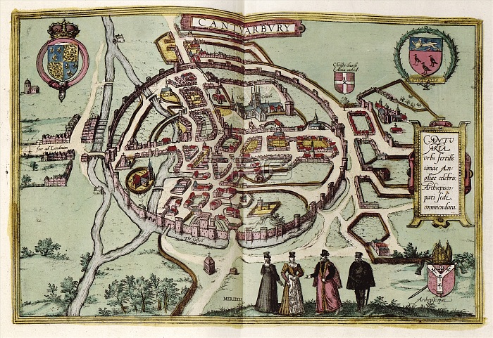
Map of Canterbury. 16th-century map of the cathedral city of Canterbury during the Tudor period. In the top corners are Tudor (left) and City (right) coats-of-arms. Canterbury Cathedral (founded 597) is at upper centre. The circular city walls and castle (lower centre) and the Great Stour river (left) are also shown. The archbishop's coat-of-arms is at bottom right, with a Latin inscription at centre right. The vignette (lower centre) shows local dress. This is a 1612 edition of a map first published in volume 4 (1588) of the city atlas 'Civitates orbis terrarum'. This atlas was edited by Georg Braun (c.1540-1622) and largely engraved by Franz Hogenberg.
| px | px | dpi | = | cm | x | cm | = | MB |
Details
Creative#:
TOP16029000
Source:
達志影像
Authorization Type:
RM
Release Information:
須由TPG 完整授權
Model Release:
N/A
Property Release:
N/A
Right to Privacy:
No
Same folder images:
 Loading